The Arcadia crew completed our first phase of excavations this summer, digging 44 shovel tests in an exploratory shovel testing program. Over 20% of the 50cm x 50 cm tests contain structural features! The torrential downpour last weekend was good and bad: most of our shovel tests flooded (often because of ridiculously high ground water levels); on the other hand, many surface features revealed themselves.
A semi-articulated brick pier surprised
us in a final shovel test. To test if there were any more structural
features hiding on the surface, a brave crew of Zach, Kyle, and Jenny
began a walking survey through some treacherous secondary brush.
After an hour of crawling through thorny underbrush, they announced
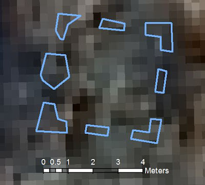
the discovery of 8 articulated brick piers! The next few days were
spent mapping, photographing, and featuring the structure.
 |
| Intense mapping underway around Structure 2. These could be the foundations of a water tower or a windmill. More evidence necessary, as always. |
 |
| A GIS overlay of Structure 2. The points used to make this map were gathered using a Total Station and data collector. |


No comments:
Post a Comment